Following the devastating 7.7 magnitude earthquake near Mandalay, Myanmar, a satellite captured images of the city shortly after sunrise on Saturday. The goal was to leverage artificial intelligence to aid relief efforts.
AI and Satellites Speed Up Myanmar Earthquake Relief Efforts
published 11 months ago
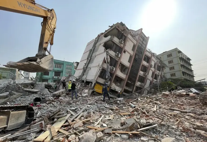
These images, combined with AI technology, would help organizations quickly gauge the extent of building collapses and damages, and pinpoint areas needing immediate assistance.
Initially, the high-tech computer vision system faced a significant hurdle.
"The primary obstacle was cloud cover," explained a data scientist. "This technology cannot penetrate clouds."
Once the clouds cleared, another satellite from Planet Labs captured aerial views, transmitting them to an AI for Good Lab. Despite the late hour, a dedicated team was ready to process the incoming data.
The AI for Good lab has previously used AI for damage assessment in events like the Libya floods of 2023 and recent Los Angeles wildfires. However, a standard AI computer vision model wasn't sufficient; a custom version tailored to Mandalay was necessary.
"The diversity of Earth, disasters, and satellite imagery necessitates customized approaches," the data scientist noted. Unlike the predictable spread of fires, an earthquake's impact is widespread, complicating immediate needs assessment.
The AI analysis revealed 515 buildings in Mandalay with extensive damage and 1,524 with partial damage, underscoring the disaster's severity and aiding in pinpointing specific areas needing help.
"This information is crucial for on-the-ground teams," the data scientist emphasized.
While cautioning that the analysis requires ground verification, the company has shared its findings with aid organizations like the Red Cross to facilitate their relief efforts.